| Author |
Message |
    
Atc_no_more
| | Posted on Tuesday, April 12, 2011 - 02:14 pm: | 


|
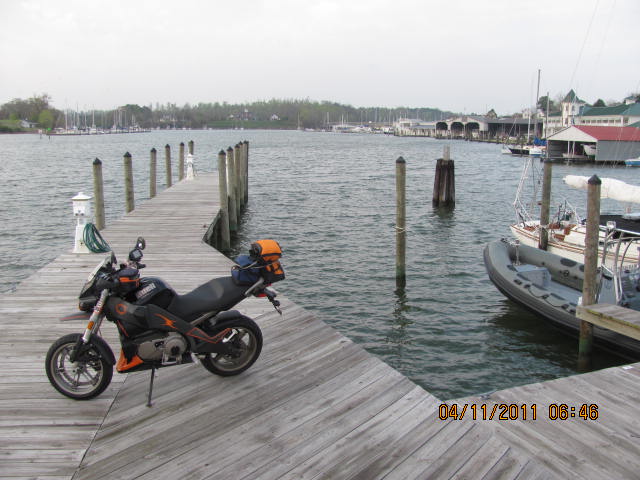
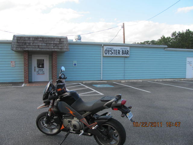
Look at the photo and try to figure out where it is. If you can�t figure it out ( I wouldn�t have if I hadn�t been there),here are three clues.
1) It was the meet up point for the kayak trip I took yesterday on the Dragon Run with the FODR.
2)The 1680 Acts of Assembly at Jamestown ordered local officials to establish 20, 50-acre port towns and this one was named in 1705.
3)Virginia State Oyster Shucking Contest is held here during Virginia�s official oyster festival.
}
|
Xb12mel
| | Posted on Monday, April 18, 2011 - 11:43 am: |
|
What is Urbanna? |
Xb12mel
| | Posted on Monday, April 18, 2011 - 11:47 am: |
|
Great clues by the way.... |
Atc_no_more
| | Posted on Monday, April 18, 2011 - 06:10 pm: |
|
Urbanna is where the rich people keep their boats. Pretty town. Definitely worth a visit. It's at the top of the Middle Peninsula on the Rappahannock River. Great riding country up there, especially Matthews County. If any of you HR Buellers want to head there, let me know. I am GPS equiped.
Where's this Buell-round 2.
Clue 1-I did 111 ( according to my GPS) over the sound bridge to get to this town.

|
Nillaice
| | Posted on Tuesday, April 19, 2011 - 08:59 am: |
|
is that the roanoke sound bridge or the washington baum bridge?
and would you happen to be at 2200 North Croatan Highway, Kill Devil Hills, NC
in the above pic? |
Atc_no_more
| | Posted on Tuesday, April 19, 2011 - 12:22 pm: |
|
The Wright Memorial Bridge.
Exactly. |
Xb12mel
| | Posted on Friday, April 22, 2011 - 08:34 am: |
|
Yeah, I remember being in that parking lot... |
Nillaice
| | Posted on Monday, April 25, 2011 - 09:24 am: |
|
where r u off to now?
or is it a "guess it right-win the next 'round" |
Atc_no_more
| | Posted on Monday, April 25, 2011 - 08:05 pm: |
|
Been no where in the last week...or have any trips in mind soon. But all it takes is the urge to roll. The Diamondback is planned in June. Had to decline a Dragon trip in May and a Laconia trip in June.
Next round is anyones go. |
Atc_no_more
| | Posted on Thursday, May 05, 2011 - 04:14 pm: |
|
No clues yet.
Anyone going to the 2011 Armed Forces Run and Rodeo at Ft. Eustis tomorrow? Surely I won't be the only Bueller there...will I? Anyway, if you go, stop by the Patriot Guard Riders (PGR) booth between 1300 and 1500. I expect to be assisting there then.
Copy and paste this E-invite for details. It says RSVP by May 4, but what the heck.
https://einvitations.afit.edu/JointBaseLangleyEustis/anim.cfm

|
Xb12mel
| | Posted on Thursday, May 12, 2011 - 05:29 pm: |
|
obviously somewhere in P-Town.... lol |
Stiguy
| | Posted on Wednesday, July 13, 2011 - 04:29 pm: |
|
I've been down there, in south Norfolk... rough part of town. |
Xb12mel
| | Posted on Thursday, July 14, 2011 - 02:47 pm: |
|
That's down the street from Nilla! |
Atc_no_more
| | Posted on Saturday, September 17, 2011 - 04:20 am: |
|
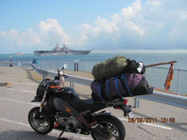
Rigged for camping and heading north. |
Atc_no_more
| | Posted on Saturday, September 17, 2011 - 04:22 am: |
|
|
Atc_no_more
| | Posted on Sunday, October 23, 2011 - 05:43 am: |
|
Bummer, the oyster bar was open yet.
|
Xb12mel
| | Posted on Tuesday, October 25, 2011 - 04:58 pm: |
|
Looks like Pax River... |
Atc_no_more
| | Posted on Tuesday, October 25, 2011 - 07:56 pm: |
|
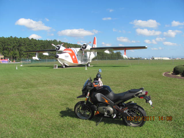
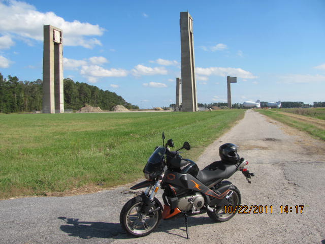
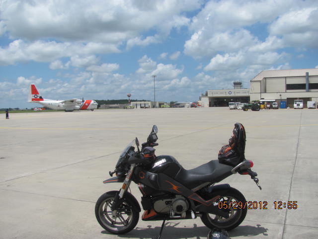
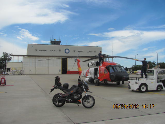
*for the Albatross photo- Location selected by the _ _ _ _ in 1938 for its potential strategic value as a seaplane base. Located sixty miles north of Cape Hatteras, North Carolina, north of Albemarle Sound and along the East Coast's northern most ice-free river, the Pasquotank. |
Atc_no_more
| | Posted on Thursday, November 10, 2011 - 04:23 pm: |
|
Where's this Buell headed?

What is the target? Hint; Look at the line on the reel)

|
Xb12mel
| | Posted on Tuesday, November 15, 2011 - 03:48 pm: |
|
What the heck is that? (No where near a fishing background )Looks like Steel! |
Atc_no_more
| | Posted on Sunday, November 20, 2011 - 06:25 am: |
|
It was loaded up and ready to go to the CBBT for stripers. |
Atc_no_more
| | Posted on Sunday, November 20, 2011 - 06:32 am: |
|
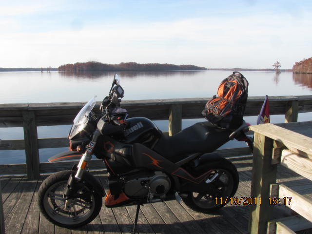
Paddlers and picnic goers alike can enjoy this site along the ------ River commemorating the Herring Fishing Industry and the important role it played in the community.
|
Xb12mel
| | Posted on Monday, November 21, 2011 - 09:29 am: |
|
That looks like the Warwick River. But that's too easy, so it's prob wrong! |
Atc_no_more
| | Posted on Friday, November 25, 2011 - 07:48 pm: |
|
Cannon's Ferry Heritage Park on the Chowan River. South of Suffolk in NC. Holliday Island in the river. |
Xb12mel
| | Posted on Tuesday, November 29, 2011 - 03:00 pm: |
|
Cool! How long did it take to ride there? |
Atc_no_more
| | Posted on Wednesday, November 30, 2011 - 05:54 am: |
|
It's about 37 miles south of the Planters Peanuts Store in Suffolk, just west of route 32. I do canoe too in that part of the world. If I could just figure out how to make a safe canoe hauler for my Uly, I'd really be livin'. |
Atc_no_more
| | Posted on Thursday, February 16, 2012 - 08:19 am: |
|
A working farm since 1617.
The Steam and Gas Engine Show in June; Pork, Peanut and Pine Festival in July.

|
Xb12mel
| | Posted on Wednesday, February 22, 2012 - 03:41 pm: |
|
Too many clues!!!
Chippokes Plantation |
Atc_no_more
| | Posted on Wednesday, May 30, 2012 - 10:29 am: |
|
Along the East Coast's northern most ice-free river-commissioned on August 15, 1940.
The tower/hanger are shown in the movie "The Guardian�.

|
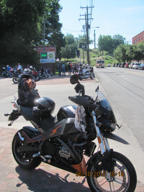
Atc_no_more
| | Posted on Sunday, June 10, 2012 - 07:29 pm: |
|
I'm absolutely sure some of you know where one of these photos is.

(Message edited by atc_no_more on June 11, 2012) |
 Hampton Roads Hooligans (VA) »
Hooligan Adventures »
Where's this Buell? »
Archive through June 10, 2012
Hampton Roads Hooligans (VA) »
Hooligan Adventures »
Where's this Buell? »
Archive through June 10, 2012