| Author | Message | ||
Iamike |
Last year I had taken a trip out to Utah with some friends http://www.badweatherbikers.com/buell/messages/6817/485991.html?1249428926 We had wanted to see where those roads off the beaten path lead to. ADVRider has many writeups on this subject but those of you with Ulys might be interested. 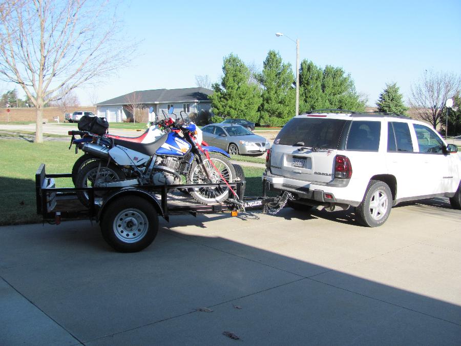 Originally another Bueller & I had discussed this trip together and it looked like his group and mine, consisting of my son, Drew, and Les, a coworker and Jeff, riding a BMW 650GS. We had picked this date in early April mainly becuase it fit our schedule and thinking that the spring break rush would be over. | ||
Iamike |
Jack bought a BMW 650GS after his XB9r had been stolen in Mexico the year before. When I told him about last year's trip he started asking me about going back with the off road bikes. I spent a lot of time researching different roads, trails, cowpaths as to the ones with the most scenery and rideable by flatlanders in a safe manner. We wanted to try and come home in one piece (more to come on that subject later). Just before time to leave Jeff backed out due to BMW sales (he's a salesman at Gina's in Iowa City) taking off like crazy. Then Jack called and one of his group member's mother dying. Then we were down to three. Drew hadn't ridden a dirt bike since he quit racing after smelling the fumes at age 16 (gasoline and perfume). I had ridden with Les in Minnesota but he recently bought a KLR650. Two weeks before the trip Drew still didn't have a bike. He ran across an '07 XR650 so he picked that up and I would be on my DR650. We made it out to Moab about 2:00pm last Thursday after a straight-through drive of 1,200mi. in 17hr.s We set up camp 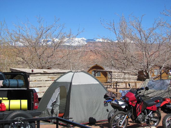 and headed out to check the bikes out. Driving past a Mexican restaurant the empty stomaches took over and we filled up with chow first. The Slickrock was going to be one destination later on in the week but being close to town we ran up there first just to look around. 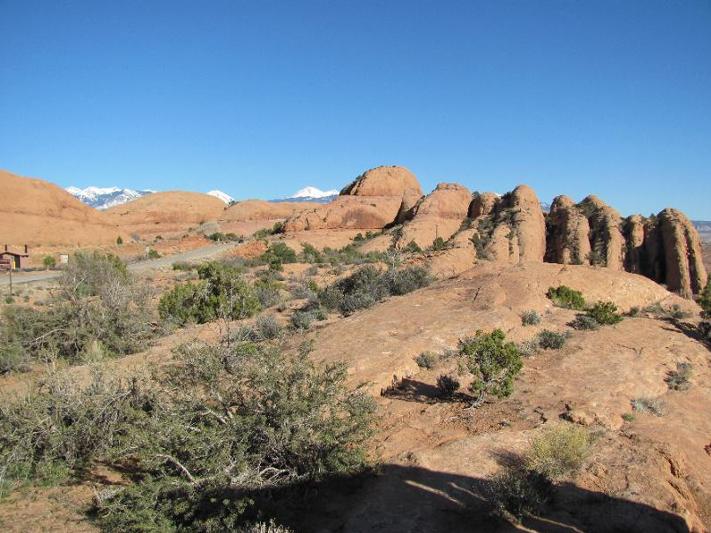 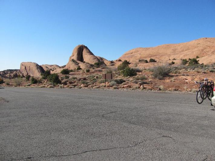 Then we took a ride up Hwy 128 along the Colorado River and a road called the La Sal Mountain Loop. 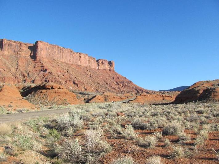 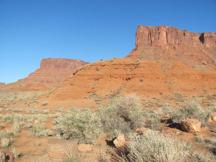 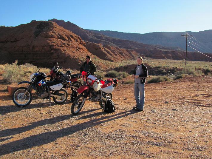 | ||
Iamike |
We hadn't planned on spending much time eating dinner and didn't realize how long the trip would take. After a quick stop at the intersection to discuss how far we would ride we headed on up the Loop Rd.  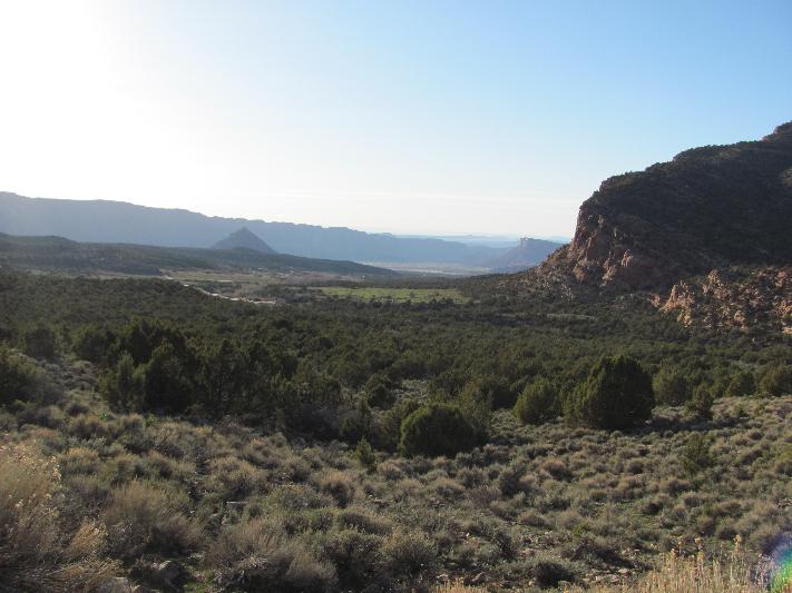 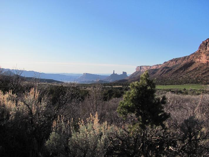 There were some residences along this part with the name of Castle Hill and I can see why. It was starting to get cold so we stopped again to talk things over and look at the GPS to see where we were at. We had ridden 35mi. and were halfway around. Then just around the corner we ran into a 'Road Closed Ahead' sign. Les wanted to go on up but as cold as I was we headed back to camp. 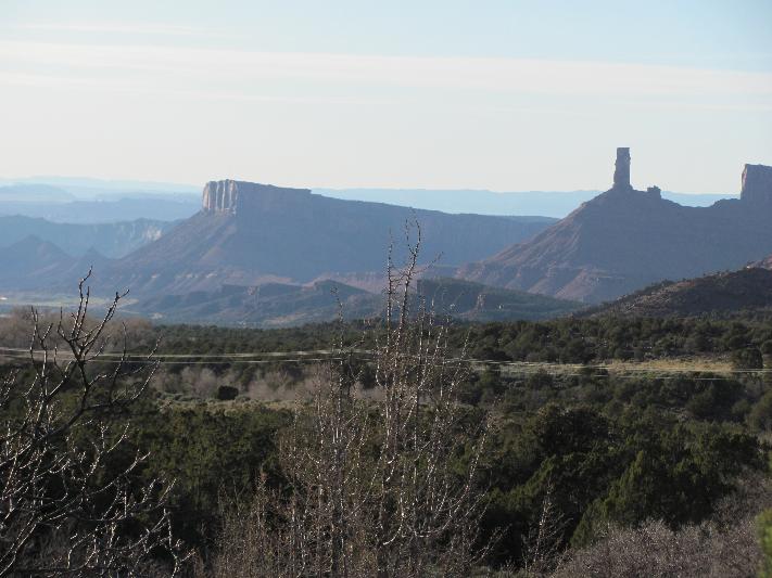 At camp we realized we had made a bad mistake of not dressing warm enough and it took quite awhile to warm up. | ||
Iamike |
One of the reasons that I wanted to get this ride in was the current climate in Congress. Not to turn this into a political thread but I had been reading at American Motorcyclist that a Democrat from New York was trying to turn this area into wilderness (even though it doesn't fit the requirement to do so). Since bicycles would be banned also it would destroy the town of Moab. In all of the research I did on route planning we wnated to do a couple of easy days and then work our way up in difficulty. I wanted to do the 170mi. White Rim Trail, Schaffer Trail up to Island in the Sky, NP, Dead Horse Point, SP, Hurrah Pass and Gemini Bridges. It will take me a few days to resize the pictures, copy the text and recover from my surgery (hint) scheduled for later on this afternoon. Stay tuned and I'll update it regularly. | ||
Iamike |
I prefer to camp on these trips as long as it isn't raining. To me it is just more relaxing to sit around the camp and shoot the bull while watching the change going on. If you have to get up during the night to venture out there is the bonus of spectacular star displays. I even got to see a great meteorite one night. You can also wander over to other sites and strike up converstations with other campers too. Most mornings we had oatmeal 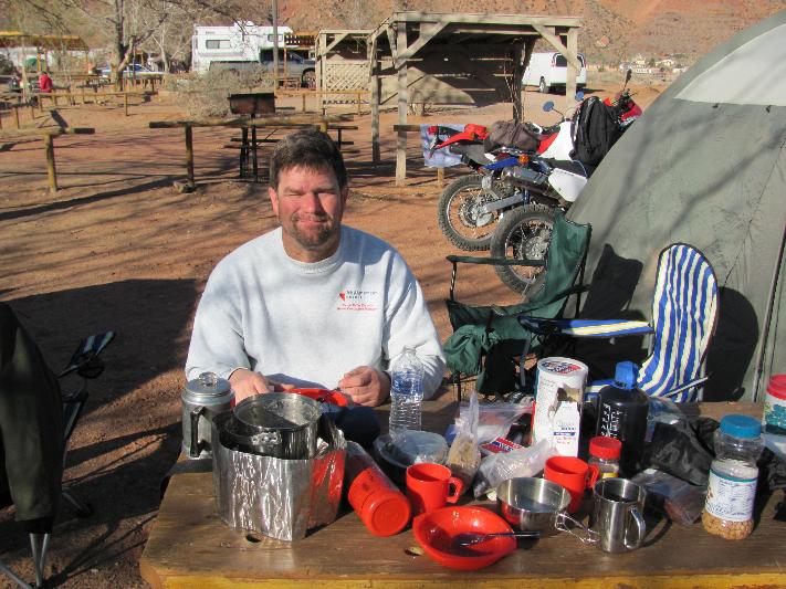 then ate bars & jerky on the trail (no 7-11s out there) and ate dinner at restaurants. To get the bike ready for the trip I added a rack to carry my tail pack and a 1 gal fuel can. Typically the DR gets 50mpg and with a 3.4gal tank that may not be enough on the day we would be going around 200mi. I had tow straps, spare tubes, tools, fist-aid kit, lots of water and food. Since I've been riding the DR for 7 years now I geared it down for trail riding and was really glad that I had since the XR & KLR still had stock gearing and had to do much more clutch slipping at times than me. I had been running knobbies but they were worn so I put the stock Trail Wings back on hoping that I would regret that decision. At times the sand was deep enough and on some of the real rocky sections the knobs mgiht have been nice but not necessary. The other two bikes had similar rears with knobby fronts. Clothing could be an issue due to the temperature swings of the dessert. The first night it dropped to 39degF but warmed up quickly as soon as the sun came out. We had highs in the 70's. I also didn't want to break down out on the trail without warm enough gear or supplies. I had brought my motocross boots for the hard day's rides but used hiking boots for the days that we'd also be doing a lot of hiking on foot trails. | ||
Iamike |
Just got a call from the hospital and my surgery is posponed until tomorrow. Now on to the story. Day 2- What a beautiful night for camping, no wind, brilliant stars to look at. I always wake up early so I got to watch the sun rise over the snow capped La Sal Mountains. 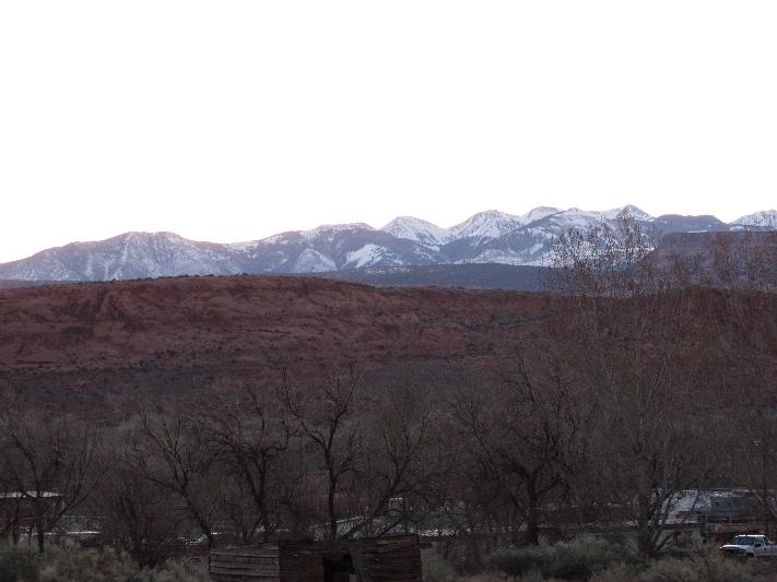 It lit up the Moab Fault on our west as it rose. What a way to start our first big day. 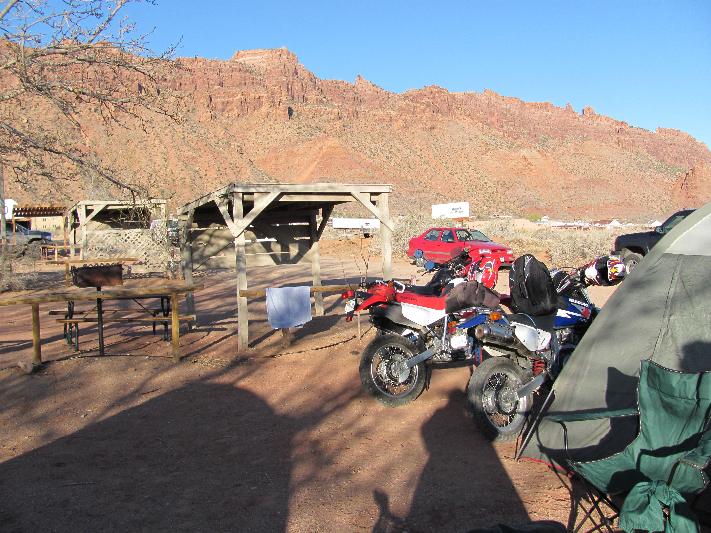  We were going to play tourist today and head out to Arches NP. Took the 3mi. hike out to the Delicate Arch. Saw an old miners shack. 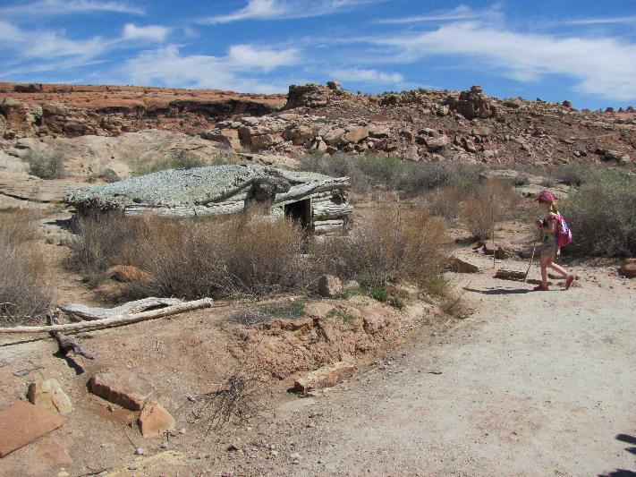 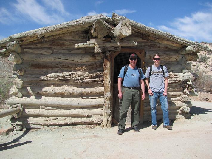 | ||
Iamike |
Next we started the three mi. trek up to Delicate Arch. I felt like I was on some sort of pilgrimage with the long line of people headed there. It was also a little hard not being acclimated to the 5,300' elevation after just one day. 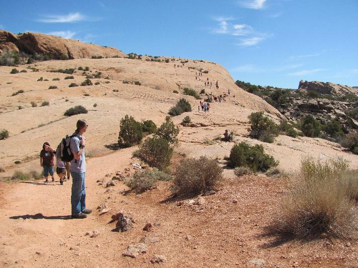 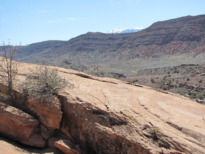 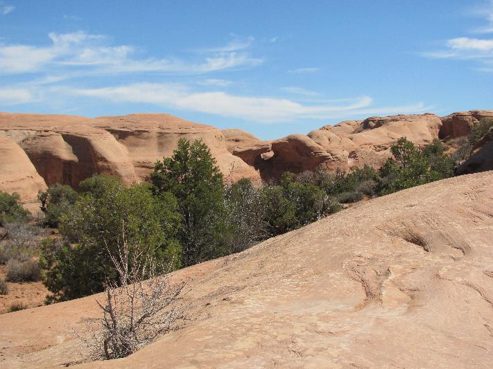 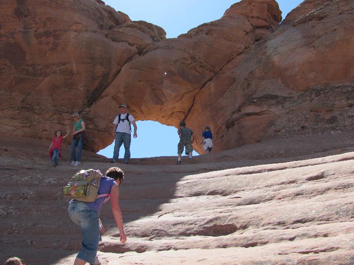 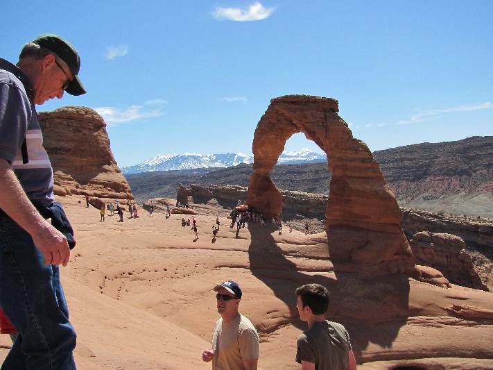 Then got to see some Indian Petroglyphs on the way back. 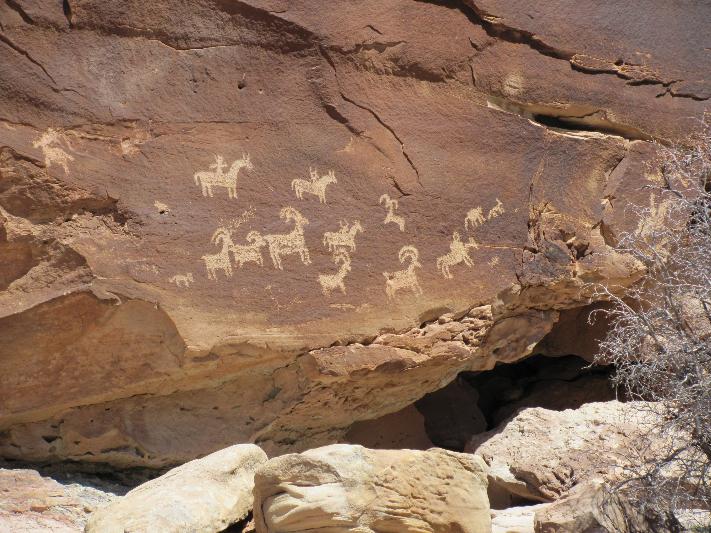 Next stop was the hike out to Landscape Arch. In '91 a huge chunk fell off the bottom while people were lounging underneath. Needless to say, they don't allow that anymore. 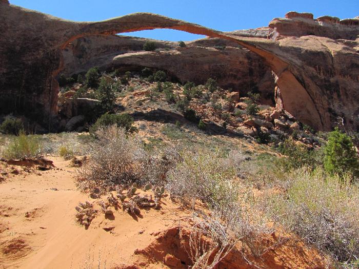 | ||
Iamike |
Les wanted to hike some more so Drew & I took off to look at some of the remote arches via back roads. It started off as an easy gravel road but started turning into more sand and rough. The turn off to the arches was real sandy and then there was a steep rocky climb. I took off 1st and then stopped partway. Not hearing Drew I hiked back down to find him picking his bike up. Unfortunately he fell on the left side bending his clutch lever, shift lever and punching a small hole in the case which was leaking oil.  It was time to head back to town to get repair supplies. JB Weld to our rescue and we were back in business. We finished the otherwise beautiful day with dinner and imbibements at Eddie McStiff's in Moab. | ||
Iamike |
At this point in the trip I was wondering how a bigger bike like a Ulysses or a GS would work out here. Several times people mentioned that we were on such 'big' bikes. We were starting to find out that in some places they were right. We trailered ours out but if you were riding an adventure bike you'd most likely ride it. That's what I found valuable with the RRs at ADVRider. I could do a lot of research on what others had done so that we didn't get ourselves into trouble that we couldn't get back out of. | ||
Bluzm2 |
Mike, Count me in next time around.. Man, I should have listened when you invited me earlier. Hmmm, need another bike.. Jan's gonna kill me! Brad | ||
Iamike |
Brad- You missed a good one. It's a tough call on what bike to use (maybe bring 2 so you could do more trails). The smaller enduroes worked out for us. Day 3- We wanted to make sure that the repairs to Drew's XR held before we attempted the long White Rim Trail. Since we could only make it halfway around the La Sal Loop we thought that going the other way would be good. Then we could hit the Slickrock in the afternoon. I missed a turn looking for the correct route and ended up driving though a neighborhood with a golf course and some gated residences. We got to what we thought was the end of the road when Drew said "That sign says 'Public Road' let's try it". The name was Steelbender and that sounded pretty intriguing to us. Steelbender dropped down into a canyon past a small field and then turned into a rough gravel road. We ran into the first of several water crossings. 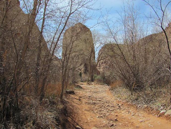 There were some sandy sections and you could tell this route was popular wit the mountain bikers (we saw some coming down the road as we were riding up to it) and one set of footprints that was probably a runner. 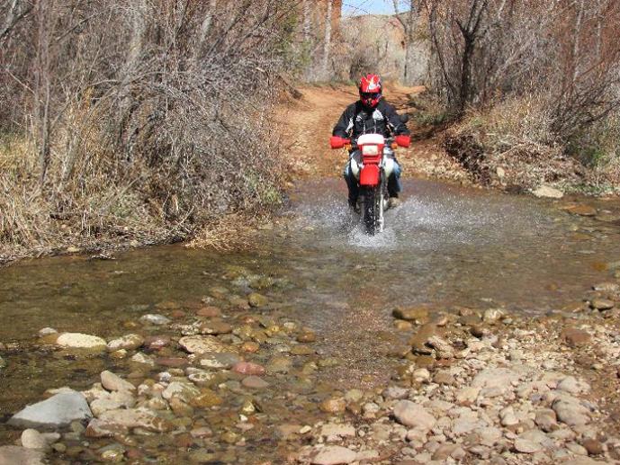 The trail was pretty slow going and fairly rough. After a couple more water crossings we came upon a bit of a steep rock dropoff. Since we were early in the trip I was lobbying against taking a chance on breaking more equipment (or boddies) so we turned back to find the La Sal Loop Road.  La Sal Loop must be a real popular ride for bicyclists, we saw several groups riding up. 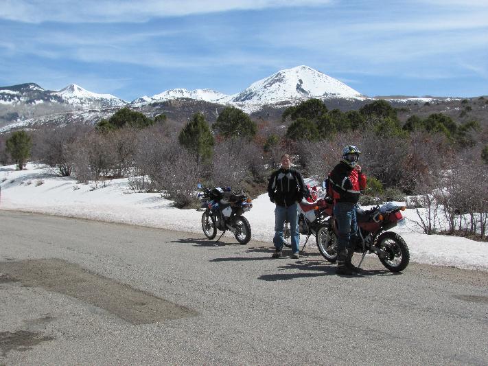 We got to the sign that said "Road Closed" so we turned off on the Geyer Pass Road. It was kind of a gravel dirt road and since we were into the snow it was kind of muddy. As the snow got deeper the road was getting muddier and the temp was quite cold with the wind blowing over the snowpack. We stopped for a couple more pictures and the headed back for the Slickrock. 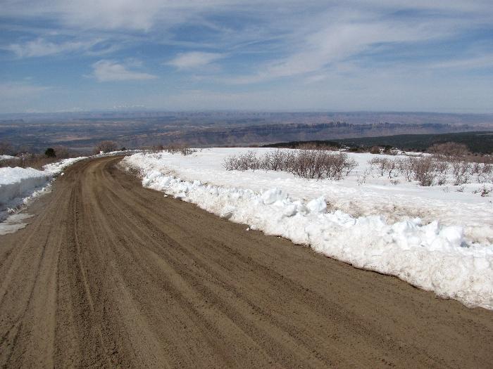  We ran across a little hillclimb on the way back that Drew couldn't resist trying out. We chickened out. 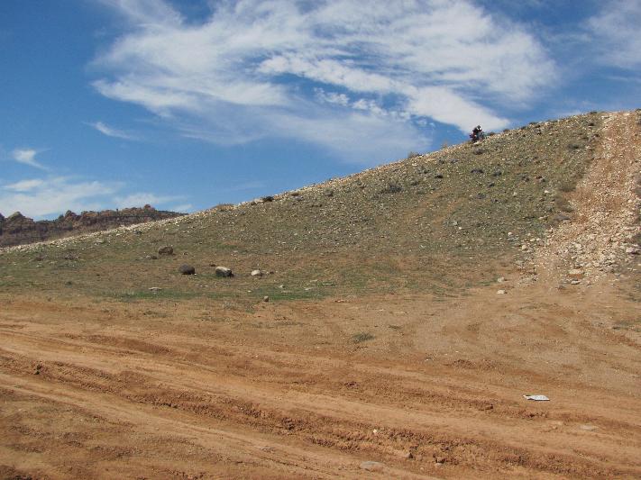 Next: Slickrock | ||
Iamike |
If you haven't ever been to Slickrock it's a pretty amazing place. It's pretty much just one huge chunk of rock that was formed from sedimentation. It's not really slippery but there are areas that are quite challenging. You may have seen a video several years ago of a full size Blazer losing it coming down one section, that is closed now. It only costs $2ea. to enter, when I first went there 20 yrs ago on my mountain bike it was free then. We started out on the section called 'Fins & Other Things'. The Fin is a formation that looks like a, well a fin. The first 1/2 mi. or so wasn't too bad at all then we hit an uphill section that was quite sandy. I got stuck right away (where are those knobbies when you need them?)but I saw a bypass and took that. We stopped to watch a jeep just drive right up it. 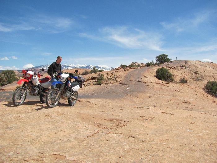 Then we hit our first downhill section that looked pretty gnarly. It wasn't so much the steepness but the realization what would happen if something went wrong. With the sand on spots and a very hard landing it can be ugly.  That went pretty well, boosting our confidence a little, then we hit a bigger one. 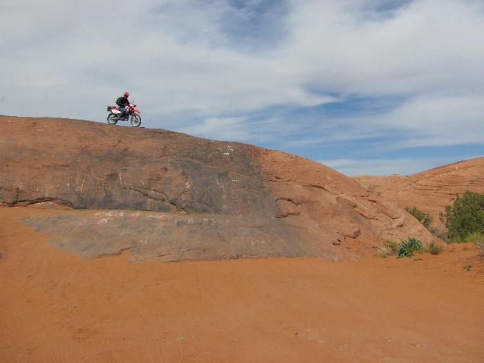 You can see the scrapes on the rock from the Jeeps bottoming out. I took a little easier route where Les & Drew went after the bigger one. 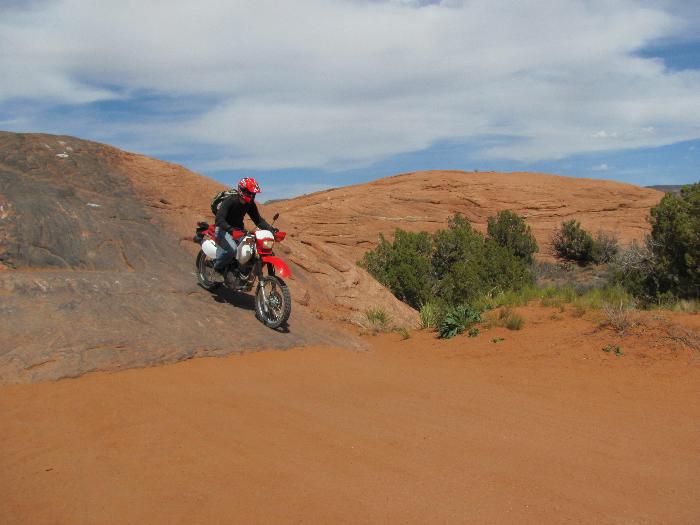 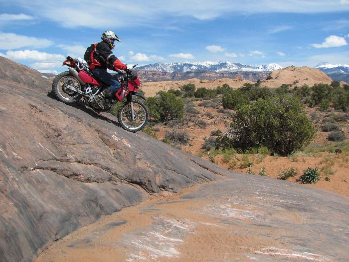 After we got past this section we went through one more that wasn't too bad. At that point I told the guys that I've had enough & I'll just watch the rest. I found a couple of nice vantage points to sit and watch them go by. 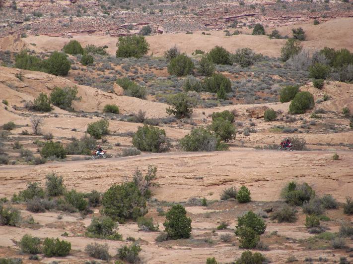 It is too far away to see in this picture but I could see one bike make it to the top but the 2nd one never showed up. I got out my binoculars to watch when finally the 2nd one made it up. 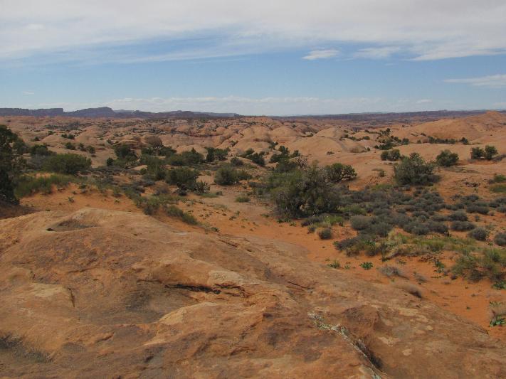 I couldn't tell which one didn't make it right away but I saw them both walking around so I figured they weren't hurt. A little later a group of jeeps drove by and said that one had a 'spill' on a steep section but no one was hurt. When they finall go back Drew had looped 3/4 of the way up a really steep section and his bike slid all the way back down. He made it on his 2nd try. Now it was back to camp for repairs and rest. | ||
Iamike |
It was too bad that I had chickened out on this section. I could have gotten good pictures or even better, video. Oh well, maybe next time. This will be our third night camping on the ground and we have already decided to stay in a cabin for the next 2 nights, ah a bed! The tent spot was $35 & the cabin $60, why are we such cheapskates? Back to the Mexican restaurant for dinner and camp for...not much talk, just sleep. | ||
Iamike |
Day 4- Time for the White Rim Trail in Canyonlands, NP. They call it that due to the white rock layer exposed at that point. You will see it when we get to those pictures. We were a little slow getting going this morning. They let us move to a cabin before we took off and then we stopped at Denny's for breakfast. I thought that the waitress was going to take Les home with her. Just a short hop North of town and we get on Co.Rd. 279. It is paved for the first 25mi. and follows the Colorado River. We pass a uranium mine at the beginning then come to a potash mine at the end. The roads start to get a little confusing not being well marked and and the GPS isn't real helpful either. At the potash mine they pump water from the river into the rock that flushed the mineral out then they add a cobalt dye to it to speed evaporation. After it dries they scoop it up and start over again. The potash is pure white when done. 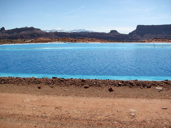 Notice how the La Sal Mountains always seem to be in the background? We head up the road towards the Shaffer Switchbacks leading up to Island in the Sky NP. The road get fairly rough and is quite precarious in places. 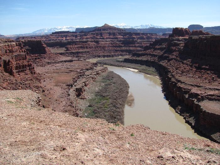  Right after standing on the edge of the precipice I notice a small hole in the ground behind me where it has been eroding. I wonder how long it will be until this section falls into the canyon? As we approach the switchbacks there is no discernable route that we can see. We also run across quite a few mountain bikes headed down. We are going to ride up that?  Partway up now. 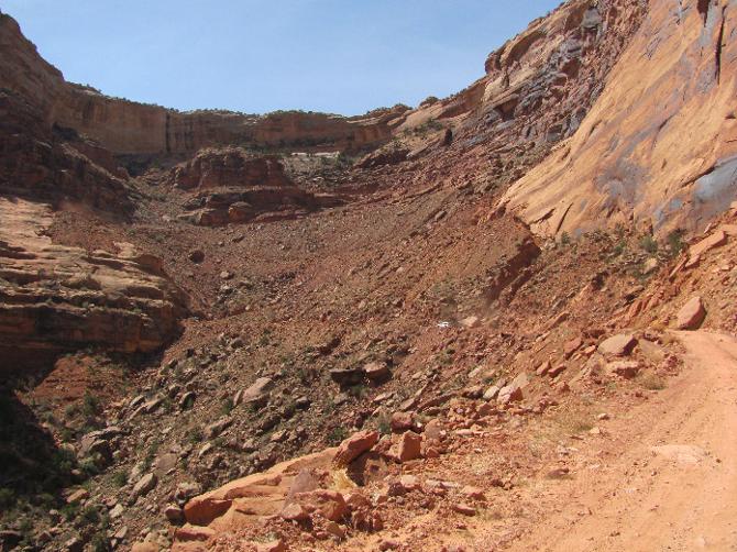 A little closer to the top.  Just about there. 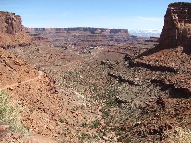 We made it! There were steeper grades than the Moki Dugway and a lot narower. This started out as a cowpath then the miners widened it. 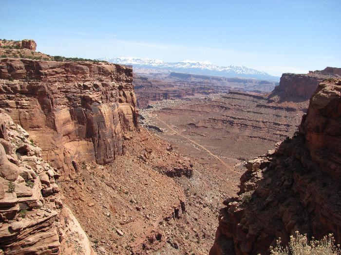 Once we got to the top we took quite a few pictures of the valley below. 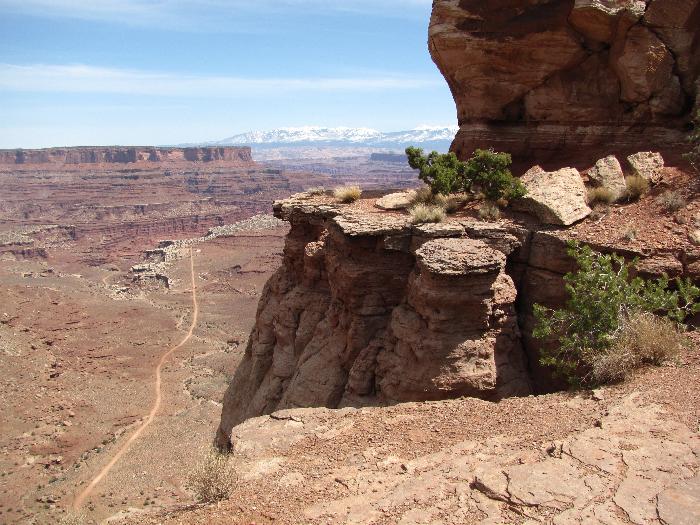 You can see the road following the white rim. 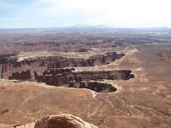 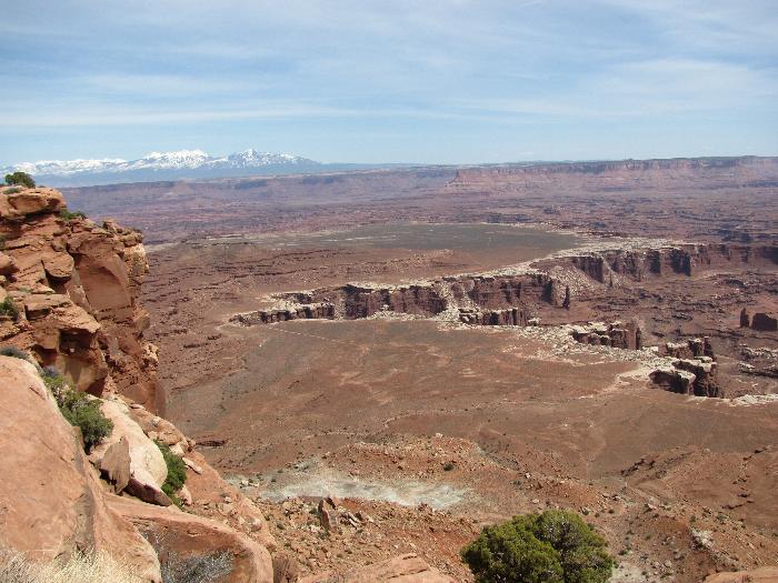 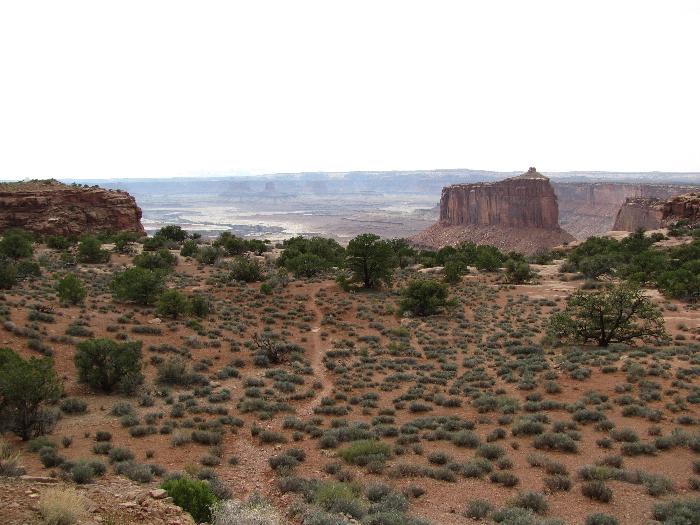 Then some picturesque shots on the plateau.  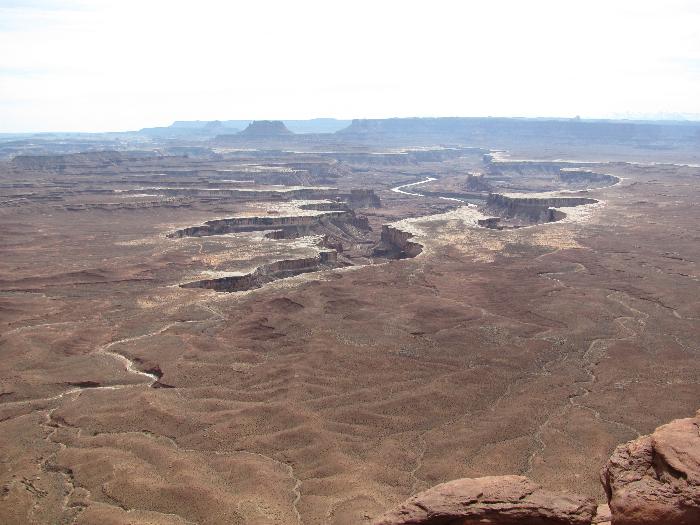  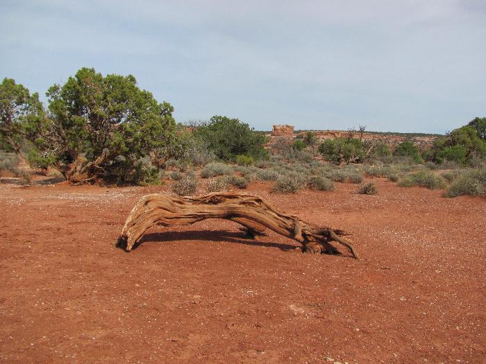 We headed back to Dead Horse SP to get a little more scenery. You can see the evaporporation ponds off in the distance. 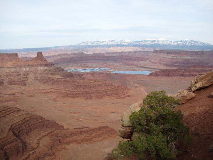  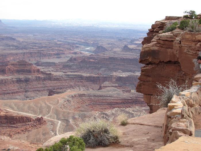 Now it is time to head back to camp. The day has been long and we passed on the 90mi. White Rim Trail (maybe another year). The road that I chose over a paved route is called the Long Canyon Rd. On the map it is much straighter than the Shaffer Switchbacks so I presume it is much steeper, I was right. There was one sandy section that I was hoping we wouldn't have to come back up on becuase we'd be pushing the bikes. I'm glad this didn't just fall! 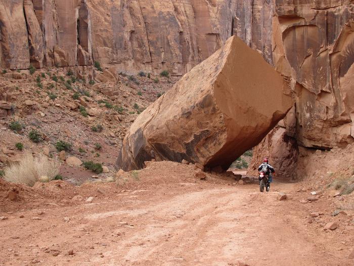 The end for today! 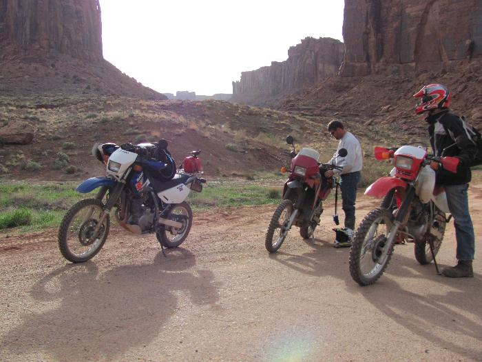 | ||
Iamike |
Day 5- We have been discussing how long to stay. I have several more days of routes in mind but Drew kind of wants to get back his scheduled WOW game. I don't quite understand the draw of that over what we are doing. The next route on my list is Hurrah Pass. today would be a good day for that since the forecast is for 45mph winds from the south. We should be sheltered in the canyon for a lot of the trip. I wake up early (as usual) and it is a bit chilly. I'm kind of hungry so I run into town for an early breakfast at McDonalds (no oatmeal today). The road out to Hurrah Pass follows Cane Creek which is the road McDonalds is on. After eating and talking about cycling with a group of guys from the state of Washington I run out Cane Creek Blvd for a few miles to check it out. There are quite a few primitive campgrounds along the way and caves built into the walls where people have garages and storage. There is also one neat stone house under construction. I turn back to stop by a cycle shop to pick up new footpegs to give Drew for his upcoming birthday to replace the ones bent the day before. Back at camp we install the pegs, load up and head to McDonalds for breakfast. Just a few miles of pavement on Cane Creek then it turns to a hard-packed gravel. It drops down into a canyon and starts getting rougher and hillier. The curves tighten and the riding gets slower, now we are in 1st or 2nd gear having to stand during the rougher sections. About 15mi. into the ride I start a tight uphill left turn when I see there is about a 2" lip so I stand up to absorb the bump. The lip is formed by a slab of stone that is covered by loose sand. As soon as my rear tire hits the sand it slides out. Since I'm standing on the pegs I can't lift my foot quick enough and the bike lands on my foot then rolls my ankle as it slides a little further before stopping. I pop out from underneath right away and Drew runs up to help me lift the bike back up as gas is coming out the vent. It is at that time I can feel the bone move in my ankle and I realize that I'm in trouble. I figure it must not be the tibia since I can stand on it and it doesn't hurt. Les wants me to take my boot off but I say that I may not get it back on so we talk about splitting up and me going back to camp. They don't want to leave me on my own so we head the 15mi. back into town. At first it doesn't hurt too much but I have to upshift once in awhile and it hurts each time. When we get to the McDonalds I stop because I don't want to take a chance on passing out while riding the highway out to camp. They go get the truck to pick me up then we head to a clinic to find the bad news. At the clinic the doctor tells me that it can't be broken since I'm walking on it but I tell him that I can feel the bone move. The x-rays confirm my prognosis and that ends our trip. Now for the 1,200mi. ride back home. I wish I would have taken some pictures that day but it didn't strike me at the time to do it. I guess by having a few more places to ride out there may be enough draw to try it in the future as long as Congress doesn't take it away from us. I'll sign off with my favorite pic from the trip:  | ||
Iamike |
I found a couple more pictures: Nice arch to ride over 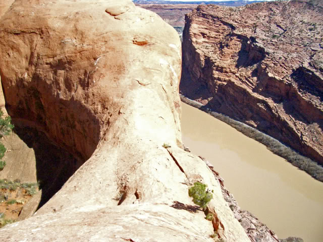 Would you do it? 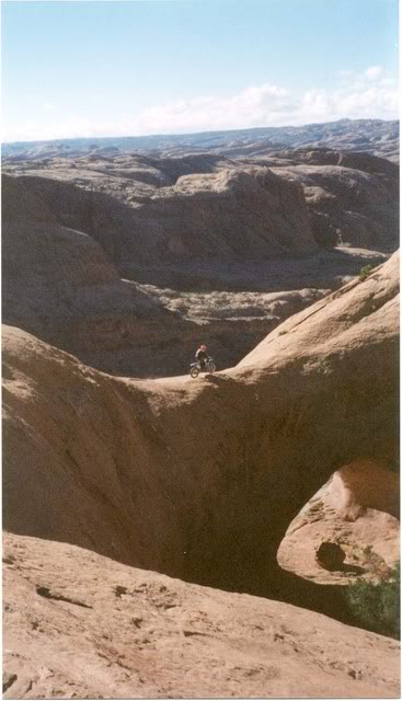 Ominous warning: 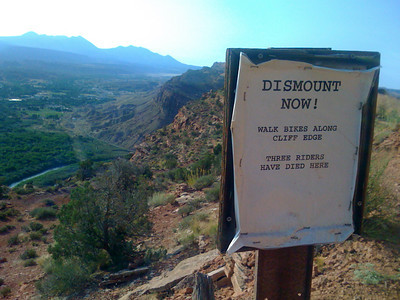 Actually I borrowed these last 3 pictures from ADVRider. I just thought that they would point out how precarious some of the riding is out here. In closing: 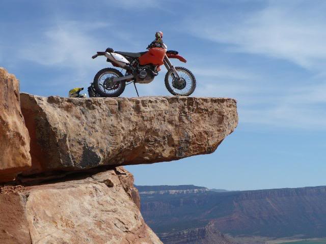 | ||
Saxon59 |
I drove the Fins&Things trail in my Land Rover one year it was great,I also did Power Pole and Onion Creek,also great trails.I was wishing I was on a bike the whole time but,I had my family with me so the L.R. had to do. | ||
Xl1200r |
I love the Moab area - I'd like to get back that way and do some off-grid riding. |