| Author | Message | ||
Fireboltgeo |
 It's time,let's start talking about the BRAG adventure in Arizona in October. Anyone registered for the ride? It's time,let's start talking about the BRAG adventure in Arizona in October. Anyone registered for the ride? | ||
Al_lighton |
OK, lets! How many badwebbers are going to this? I'll be signing up some time this week. The agenda for the thing is a little ambiguous. Friday starts with the dealer party/Check-in from 10AM-3PM at Chosa's in Mesa, AZ. That's just east of Phoenix next to Tempe. Saturday, the ride meets at Licano's Mexican Steak House (573 W Deuce of Clubs, Show Low, AZ). That looks to be about 2 hours away via straightest route, but I'm just guessing from mapquest. Seems silly to go to Mesa on Friday and hang there for any length of time. Better to check in there early and hit the road early Friday to get to Show Low the long way. Not sure what self guided rides they've got planned, but if one was to make a BIG day of it, I think you could get a loop north up thru Sedona and Oak Creek canyon, then loop back down at Flagstaff back towards Show Low thru Mormon Lake, Payton, Forest lakes, etc. But you wouldn't want to show up at Choso's at 1 or 2 PM and expect to be able to do a loop that big, I don't think. Any AZ riders out there that could comment? Is that an overly long ride? I've been thru Oak Creek Canyon a couple times, once on a motorcycle, and it's a cool place that MUST be seen. And if that is too long, what reasonable length scenic/twisty alternatives exist to get from Mesa to Show Low? It'd be a shame to just blast there across a desert highway because of hanging at the dealer too long. Frankly, I'd expect BRAG to be a little clearer about at least the Friday agenda, i.e., to have the times for the suggested routes from Mesa to Show Low published, and provide some guidance on the start times for those. I can ride by myself any time, the reason for these rides is to connect with other riders in small groups to share the experience with. But if I don't have any idea what the rides are until I get there that day, I can't make plans for being there by a certain time. I've done some internet looking on the other destinations they've mentioned for Saturday/Sunday, but nothing is listed for Friday to do some net searching on. BRAG, if you're listening in, please clarify the possibilities for Friday if possible. I just sent in reservations at the Days Inn ($57.xx) in Show Low for Friday/Saturday night, not confirmed. Darryl (Sparky), you looking for a roomate to cheap out? My plans would be to arrive in the phoenix area thursday eve with the bike in the trailer, hopefully the dealer will let me park the truck/trailer there for the weekend. Friday, long route to Show Low, Saturday Show-low loop, Sunday eventually back to Mesa, Monday back to CA. You still interested in trailering there, and does that schedule work for you? wordy SOB, ain't I? Al | ||
Al_lighton |
One other thing... You may want to consider plugging in some of the locations we'll be at in weather.com and look at the records/averages sections. We will be riding thru some areas that have pretty good altitude, and morning temps are going to be chilly. Snow isn't likely, but it IS possible in October. Al | ||
Jim_witt |
Al, If my house in Pine was closer to being livable, you could stay there. We�re shooting for a November date at the moment but I�m not sure if that�s even possible. Having some major problems with a few contractors. The route you�re suggesting for a Friday ride is a great idea and do'able, very scenic to say the least but it would be a rather lengthy ride. Especially considering what�s on the horizon, meaning the Coronado Trail, AKA the Devils Highway, Dead Mans Highway, Route 666 �� now called Route 191 or the B.R.A.G.Torque Fest). To do it right you�d need to leave Phoenix and get on I-17 North which has some nice long sweepers, get off the Interstate at Cordes Junction (or Camp Verde) and go West to Prescott. After gassing up in Prescott head out North on ALT 89 to Jerome to Sedona. The best part of the ride is FROM Sedona to Flagstaff on the Old Oak Creek Canyon trail (still ALT 89). It has some pretty nasty twisties and very narrow. The best way to get back to Show Low from Flagstaff would be to take I-17 South (nice Interstate drive BTW) down to the Camp Verde area and get on 260. Extremely nice ride as well through Pine, Strawberry, Payson, Kohl�s Ranch, Christopher Creek, Overgaard, Pinedale to Show Low. All of the above is some of Arizona�s prime scenery. Elevations range from say 3,000' to 8,000'. The Interstate speeds are great 75mph + but a butt load of Highway Patrols. Excessive speeding in Arizona isn�t a great idea, they�ll hang your ass in a heartbeat. One a side note, if you end up going on Highway 87 from the Phoenix area to Payson (which I drive every week) is always on radar! Got'ta watch your speed limit there. It's much slower than anywhere else in Arizona! It�s almost double lane highway all the way to Payson. It�s very �smooth�, long sweepers and scenic. You WILL get a ticket if speeding and the Highway patrol hides in the bushes so you can�t see them. They park exactly the same spots all the time. This is probably the route they'll suggest. Now for the Coronado Trail (Torque Fest) jamboree deale�o. I grew up in the area. I�m a 4th generation Arizonian and all my family roots are from the Greenlee County areas (cattle ranches, sheriff, etc.). I�ve ridded the Coronado Trail on a motorcycle hundreds of times over the years. The camping is supreme along with absolutely incredible scenery in the area of Alpine and Hannagan Meadow. Although once thriving communities, Clifton and Morenci are �old� run down Phelps Dodge mining towns. If you�ve never seen an open pit mine, you�ll find it overwhelming and interesting. The Morenci mine is the largest copper producing operation in North America. Clifton although a dive nowadays, as is Morenci, has small crude jail along side Chase Creek Street (just the main street you drive through) and you can still see it today. If you�re an �Old West� fan, it�s something to at least say you physically visited. The small jail was blasted out of the side of the granite cliff. This was a tough old West county. My Grandfather was Sheriff in Greenlee County in the late 1800�s and my Dad told me many harry stories. It is claimed that none ever left the Clifton jail except under escort. The Lesinsky brothers, owners of the mines, enlisted Margartio Verala to build the jail. The story goes on to say that upon the completion of the jail, Verala went out to celebrate. He got to carried away and shot up the dance hall and ended up becoming the jail�s first guest. Oops, I got carried away on a little Old West History ... duh. Back to Torque-Fest ...... I�ve never seen a Highway Patrol anywhere on Route 191 itself. The speed limit is between 15 and 25 mph throughout the 80-mile or so jaunt. Elevations range from 6,000' to around 11,000'. It usually rains pretty heavy too! It is indeed treacherous (to say the least), narrow, lengthy, with extremely varied scenery, large elevation changes and of course beautiful. I can�t image a ridding this thing with a group of hooligans that I don�t know. Plus I�ll be completely and totally amazed if no one bites the asphalt. Anyway, if you navigate to this link route 666 or route 191 is in red. Once there, notice you're located in the Clifton and Morenci area. If I understand the trip correctly, this will be the end of the Arizona side of the Torque Fest ride. You'll then cut over into New Mexico and go back North to Show Low. Click the green North arrow at the top/middle of the map and see how extensive US 666 is. It will take you several clicks to view the entire adventure. Wordy ... naw, -JW:>  edited by jim_witt on August 11, 2003 | ||
Al_lighton |
Jim, You gonna be riding this thing? If yea, I want to ride with you! Nothing like having a local about to know all the cool stuff that I'd probably blast right by. | ||
Al_lighton |
Jim, does AZ predominantly use instant-on radar, or do they tend to just blast continuously? In other words, is a radar detector generally useful for protection, or not? Mostly K/KA band? Laser? | ||
Jim_witt |
Al, I don't know a thing about radar detectors and never owned one of the pup(s). Just figured they were a waste of money and something else to waste time on using. Of course I never did any sort of technical research on them either to make an intelligent decision. Don�t know that I have the skill to do so in the first place if I wanted to do the research. Dunno if I'll ride or even attend. Like I said, I can't even remotely see this puppy working if the Harley folks are part of the Torque-Fest. I've been on quite a few "Harley Parades" (so to speak) in years past with Hacienda HD and Chosa's HD and they're not up to anything like this trip. I'm pretty sure I'll attend the event to take pictures. I seriously doubt many Arizona HD or Buell folks have ever heard of the Coronado Trail or even driven on it in a car (let alone a motorcycle). You'd be suprized how many folks that live in Arizona haven't a clue it exist! -JW:> | ||
Al_lighton |
Well, Jim, BRAG has done a few that have worked pretty good, near as I can tell. The cali ride last year was hardly a parade lap of california. Serious mileage, twisties, and fun, with only a few minor mishaps. Leslie did a great job of it. It's new folks this year, but if they do half as good a job, it'll be fun. I hope you can make it for at least part of it. Al | ||
Jim_witt |
Al, I'm not knocking B.R.A.G., Torque-Fest, or the Coronado Trail. Route 191 is one of my favorite rides in Arizona. I relate it to the Arizona version of Slay the Dragon but 80 miles instead of 11. -JW:> | ||
Sparky |
Al, Count me in. Your plan/schedule for hauling the bikes sounds good. I need to register soon to scope out the routes BRAG has planned. I've only been through that part of Az once before. This should be a real treat. 11,000 ft huh. Remind me to kick myself if I forget the e-vest! Jim, What Al said. It'd be an honor to have a fellow Team Elves Bueller show us around. "Arizona version of Slay the Dragon"!!? Sounds challenging. I'll hafta take your word on that, for now. Thanks, Sparky | ||
Al_lighton |
Sparky, Cool. I haven't registered yet either. In fact, I didn't join BRAG this year, just didn't give me any value for my $$$. I was just about to when I heard they were pulling any activities out of Laguna Seca. Torque-fest is $65 for non Brag members, $45 for BRAG members. Maybe it's worth it to pay the $40 to save $20, but I couldn't really give a damn about patches, pins, and such. I'll figure it out by the end of the month. Jim, I've never done any HOG rides, but from what I've heard/seen, BRAG does things a little differently. BRAG is just a facilitator, coordinating logistical things like hotel reservations, bike transportation to events, dealer parties, a breakdown sweep vehicle, and SUGGESTED routes. But for the actual ride, everyone is kinda on their own, free to form little packs of reasonable sizes and compatible skill levels. On the california ride, the largest group I rode with was about 20 people, and even then, it fairly quickly divided into two or three groups, with a fast pack and a slow pack. It generally seems to work OK. No roving packs of 50+ bikes put-putting too close together, they are sport rides to be sure. | ||
Jim_witt |
Al, Just to let you know, I've been on more than one B.R.A.G. ride, the first being in 98 in New Mexico. I couldn't find any GOOD pictures giving the Coronado Trail any visual justice. Most of the images below are low to medium desert outside of Morenci area. I know it's about 90 miles between Clifton and Alpine with approximately 460 curves on the Coronado Trail. 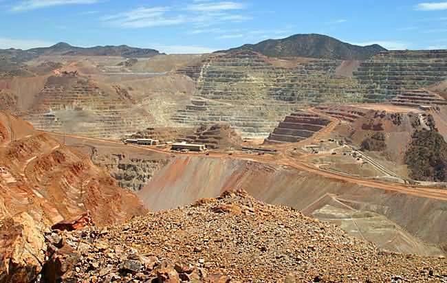 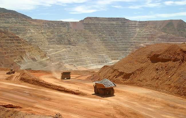 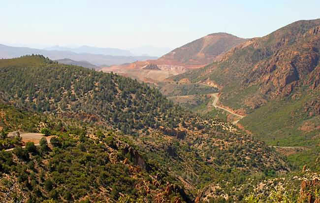 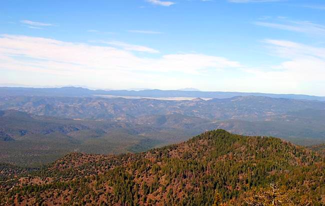 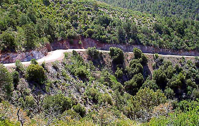 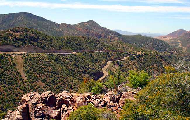 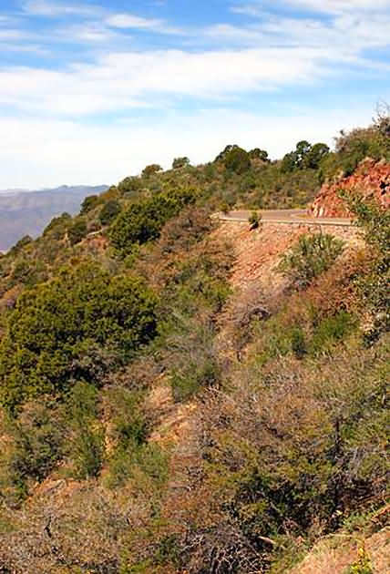 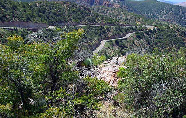 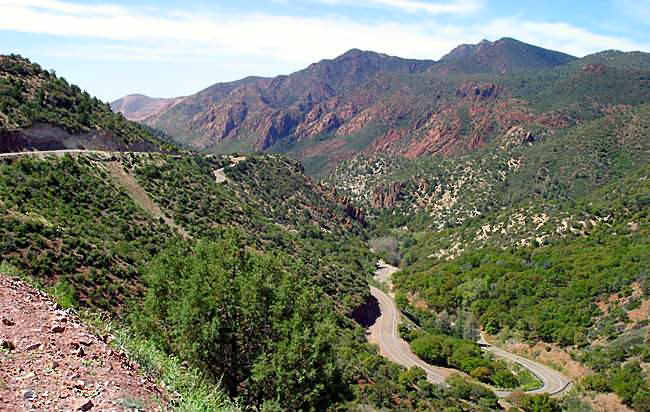 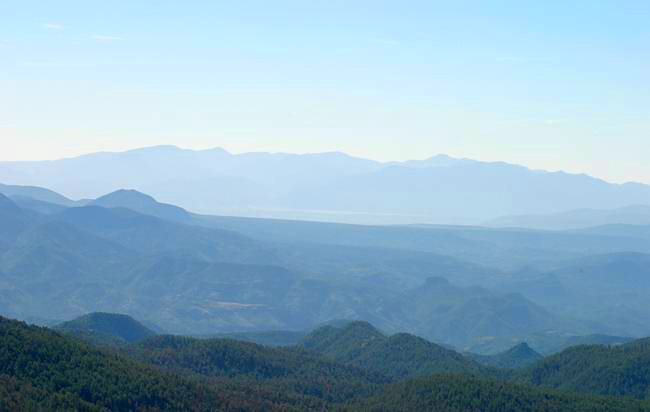 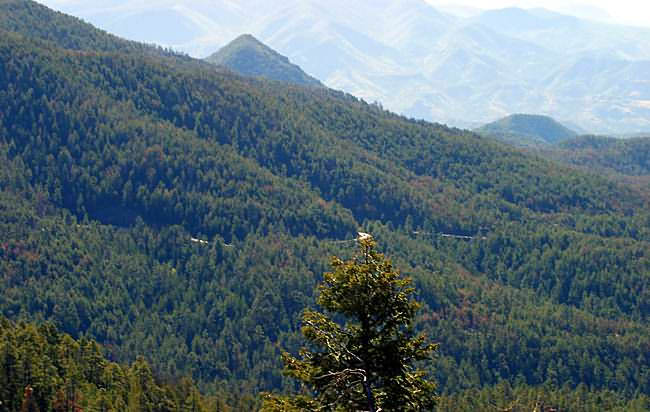 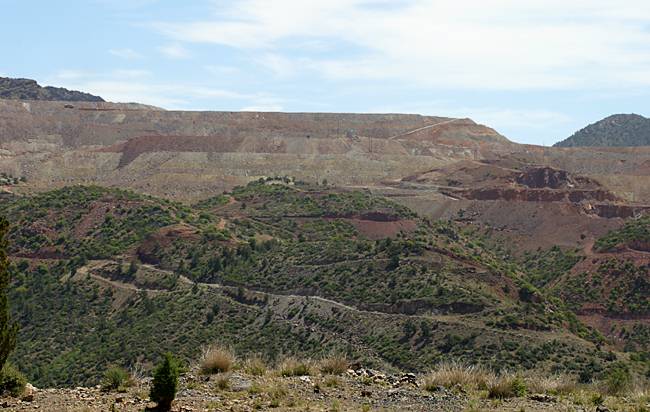 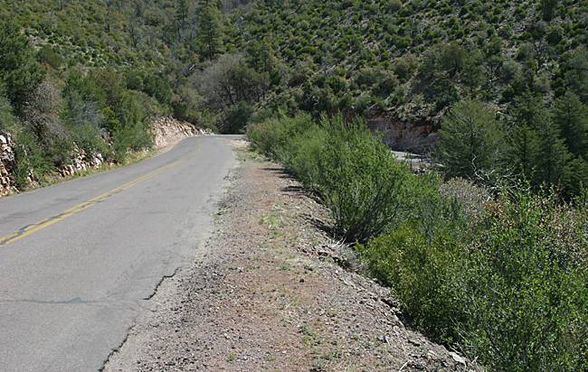 I'll post better pictures in the next couple of weeks once I take them. Check out the switch backs in the picture that is second from the bottom. I can just see a group of HD riders taking the turn pictured above. -JW:> edited by jim_witt on August 12, 2003 | ||
Fireboltgeo |
Jim, Thanks for the great pics. This looks like Firebolt Heaven to a flatlander from Ohio. Mary from BRAG told me this week via email there are about 25 folks registered so far. I look forward to seeing you all in October. George | ||
Steveh |
anyone from southern california, looking for a ride partner and/or want to share hotel room in AZ? email roadx@san.rr.com | ||
Jim_witt |
Torque Fest, I put together a few temporary 3D and 2D topo images of the 2003 B.R.A.G. Arizona Torque-Fest route between Clifton and Alpine Arizona to give you Hooligans and idea what one-half of the actual run will be like. Meaning the Arizona side. More detailed images will be posted in the next few weeks. -JW:> edited by jim_witt on August 20, 2003 | ||
Al_lighton |
Jim, How do you make those jpgs? | ||
Steveh |
Al have you committed to going on torque-fest? | ||
Jim_witt |
Al, Check this puppy out. Poor quality due to upload filesize but rather cool! Haven't had any time this week to do much. Been driving up to Pine every morning, hanging dry wall and driving back every night. Pretty hard work for an old guy. Put your pointer over the image. 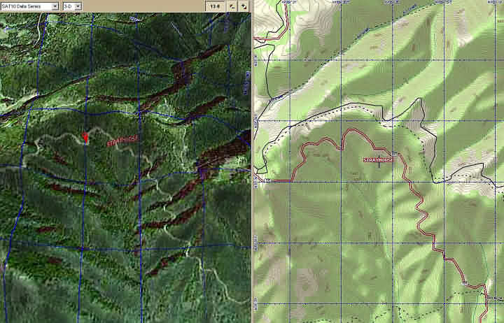 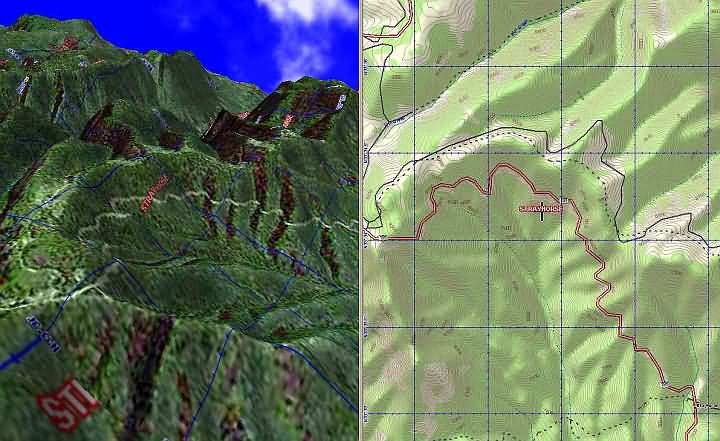 -JW:> | ||
Turnagain |
pretty twisted there Jim.  | ||
Al_lighton |
Pretty cool, Jim. Looks like a very fun road. But I'm curious HOW are you doing these 3D topo images? What SW lets you take the topo map and create the 3D surface? I know the high rent Civil Engineering CAD programs let you do this, I'm curious if you have access to that or a different way of doing it. |